

Ben Nevis [Beinn Nibheis]
Good walks are even better shared.
Overview
Ben Nevis
Overview
Ben Nevis is the highest mountain in Britain. Ordnance Survey measured its highest natural point at 1,344.527 metres in 2016; published maps round this to 1,345 metres.
Choosing an approach
The Mountain Path from Glen Nevis is the standard walking approach. It is a strenuous mountain day with a rough upper section, not an easy stroll because it is sometimes called the Tourist Route. Other approaches require their own route planning and skills assessment. Use a detailed map and a current route description rather than this overview for navigation.
Summit and geology
The summit area contains a trig point and cairn, an emergency shelter and the ruins of the former observatory. The observatory closed in 1904. The summit-area volcanic formation includes andesitic lava and volcanic breccia; the earlier description of granite as volcanic rock was inaccurate.
Access
The Ben Nevis Visitor Centre car park in Glen Nevis is a common Mountain Path starting point. Check parking charges, opening arrangements and any event requirements before travelling. Fort William is the main nearby town. Bus services into Glen Nevis can be seasonal; check the actual timetable and return journey.
Conditions and safety
Cloud can hide the route and the steep drops near the summit plateau. Snow and ice require suitable winter skills and equipment, even when conditions lower down seem mild. Check the mountain forecast, prepare for changing weather and allow enough daylight and time for the descent. Carry a map and compass and know how to use them; phone navigation alone is not a substitute for preparation.
Name and history
The English name comes from Gaelic Beinn Nibheis. The meaning of Nibheis is uncertain, with several interpretations proposed. The mountain has a long mountaineering and scientific history, including the summit observatory.
Sources checked
- Ordnance Survey: Ben Nevis resurvey
- British Geological Survey: Ben Nevis Volcanic Formation
- John Muir Trust: summit ranger observations
- Met Office: observatory history
- Walkhighlands: Mountain Path
- High Life Highland: visitor information
Reviewed 15 October 2026. Conditions and access arrangements can change.
Explore routes near Ben Nevis [Beinn Nibheis]
Walks starting near this hill. Open a route to check its map, distance and full itinerary.
Ben Nevis via Mountain Path
View route
Banavie to Glen Loy Aqueduct: Neptune’s Staircase Canal Towpath
View route
Coire Ardair lochan from Aberarder and back
View route
Fort Augustus to Kytra Lock: Caledonian Canal Towpath
View route
Route planning notes
These notes describe possible approaches. Check a route's map and access information when planning your walk.
The Mountain Track (Tourist Route)
From Glen Nevis Visitor Centre, ascend the Mountain Path and return the same way. Walkhighlands gives about 17 km and 7–9 hours. This is a strenuous mountain walk with rough upper terrain. Cloud or snow can hide the path beside dangerous summit gullies; navigation skills are essential. Snow and ice require winter equipment and skills.
The Carn Mor Dearg Arete
From the North Face car park near Torlundy, climb Carn Mor Dearg and traverse the exposed arete to Ben Nevis. For experienced, fit mountain walkers with scrambling skills. The Walkhighlands circuit returns via the Mountain Path and the lochan area, with a pathless section and burn crossing: about 17.5 km and 10–11 hours. Other descents change the distance.
The Ledge Route
A serious, exposed scramble approached from the North Face car park towards the CIC Hut. It climbs to Carn Dearg; Ben Nevis summit lies farther across the plateau. Published summer grades vary, commonly Grade 2. Route-finding and scrambling competence are essential; snow or ice makes this a winter mountaineering undertaking. Plan the descent separately.
The Halfway Lochan Route
A shorter out-and-back walk using the lower Mountain Path from Glen Nevis towards the plateau beside Lochan Meall an t-Suidhe, returning the same way. This does not reach Ben Nevis summit. The main path passes above the lochan rather than reaching its shore. Choose the turnaround point on a map.
The Allt a' Mhuilinn Path
From the North Face car park near Torlundy, follow the Allt a’ Mhuilinn approach towards the CIC Hut and return the same way. This is a walk beneath the cliffs, not a walking route to Ben Nevis summit. The hut is private. Walkhighlands gives about 10.25 km and 3.5–4 hours for its North Face walk, with 630 m of ascent. Summit extensions require a separately planned mountaineering route.
Make a day of it, together
Find someone to share the walk with, or organise a day out along a route you like.
Photo Gallery
View all Photo could not load
NN1671 : The summit, Ben Nevis
Roger Cornfoot
 Photo could not load
NN1671 : Summit of Ben Nevis
Steven Brown
 Photo could not load
NN1671 : Ben Nevis from Beinn a' Bhric
William Starkey
 Photo could not load
NN1671 : Beinn Nibheis from Corpach
Anne Burgess
 Photo could not load
NN1671 : Trig point on Ben Nevis
Roger Cornfoot
 Photo could not load
NN1671 : Ben Nevis from Stob Coire Sgreamhach
Scott Cormie
 Photo could not load
NN1671 : Ben Nevis from Corpach
Steve Fareham
 Photo could not load
NN1671 : Summit, Ben Nevis
Richard Webb
 Photo could not load
NN1671 : Ben Nevis Trig Point
John Fielding

NN1671 : The summit of Ben Nevis in June
Ian S
Hill facts and local notes
Classifications
Elevation
1,345m
4,411 ft
Prominence
1,344m
Coordinates
56.7969, -5.0037
NN166712
OS Map
41
Explorer: 392
At the Summit
The rocky summit area includes the summit trig point and cairn, an emergency shelter and the ruins of the historic observatory, which closed in 1904. Views depend on cloud and visibility.
Terrain & Geology
The summit-area rocks include andesitic lavas, volcanic breccias and agglomerates, described by the British Geological Survey as the Ben Nevis Volcanic Formation.
Views & Scenery
In clear weather, views extend across the surrounding Lochaber mountains and towards Loch Linnhe and Loch Eil. Cloud often hides the panorama.
History & Heritage
Name Origin
Ben Nevis is the English form of Gaelic Beinn Nibheis. Beinn means mountain; the origin and precise meaning of Nibheis are uncertain, with several interpretations proposed.
Historical Significance
A meteorological observatory operated on the summit from 1883 to 1904. Its surviving ruins are a reminder of the mountain's history of weather observations.
Getting There & Facilities
Parking
Ben Nevis Visitor Centre car park in Glen Nevis (NN122730) is a common Mountain Path starting point. Check current parking charges and opening arrangements before travelling.
Public Transport
Bus services into Glen Nevis can be seasonal. Check the current timetable and your return journey before relying on public transport.
Nearby Facilities
Ben Nevis Visitor Centre provides walking information, weather updates, a shop and hot drinks. Check current facilities and opening times before visiting. Fort William offers wider services.
Safety Information
Known Hazards
- Steep cliffs and gullies border the summit plateau. Cloud or snow can hide the path; map-and-compass navigation skills are essential.
- Snow and ice can persist into early summer and require appropriate winter equipment and the skills to use it.
- Check mountain weather and avalanche forecasts, and be prepared to turn back if conditions exceed your experience.
General Safety Tips
- Check weather conditions before setting out
- Carry appropriate clothing and equipment
- Let someone know your planned route
- Take a map, compass, and GPS device
- Carry emergency supplies: food, water, first aid kit, torch
Hills
Some common questions about the hills answered
Are there group walks up Ben Nevis [Beinn Nibheis]?
Many walkers use Walkmates to join or organise walks with others. You can check for group walks around Ben Nevis [Beinn Nibheis] through the maps
Are there other walkers around Ben Nevis [Beinn Nibheis]?
Activity varies by location and time, but Walkmates lets you see whether others have shared walks or shown interest in this area. Find other people through the walking friends search walking friends for Ben Nevis [Beinn Nibheis] search or of course create your own walk for Ben Nevis [Beinn Nibheis]
Can I organise a walk to Ben Nevis [Beinn Nibheis]?
Yes. If there aren’t any walks listed already, you can create a walk and make it available for others to join.
If you're signed up to Walkmates, you can create a walk to Ben Nevis [Beinn Nibheis].
How do I find a walk up this hill?
There are often multiple ways to walk this hill, depending on experience and route preference. Walkmates helps you explore walks and routes that others have shared.
Can I suggest a new route up Ben Nevis [Beinn Nibheis]?
Yes. You can suggest or create routes to share with others. Walkmates focuses on the social side of walking, so routes are used to help people organise walks and explore areas together, rather than as detailed navigation tools or route libraries.
Other uses really appreciate knowledgeable walkers sharing their routes. Share your favourite route to Ben Nevis [Beinn Nibheis] here
The is an error or something incorrect about this hill. How do I let you know?
We always strive to keep the information on Walkmates as accurate as possible. If you find an error, please let us know through the contact form and we'll aim to correct it as quickly as possible
Community Discussion
Comments
Location
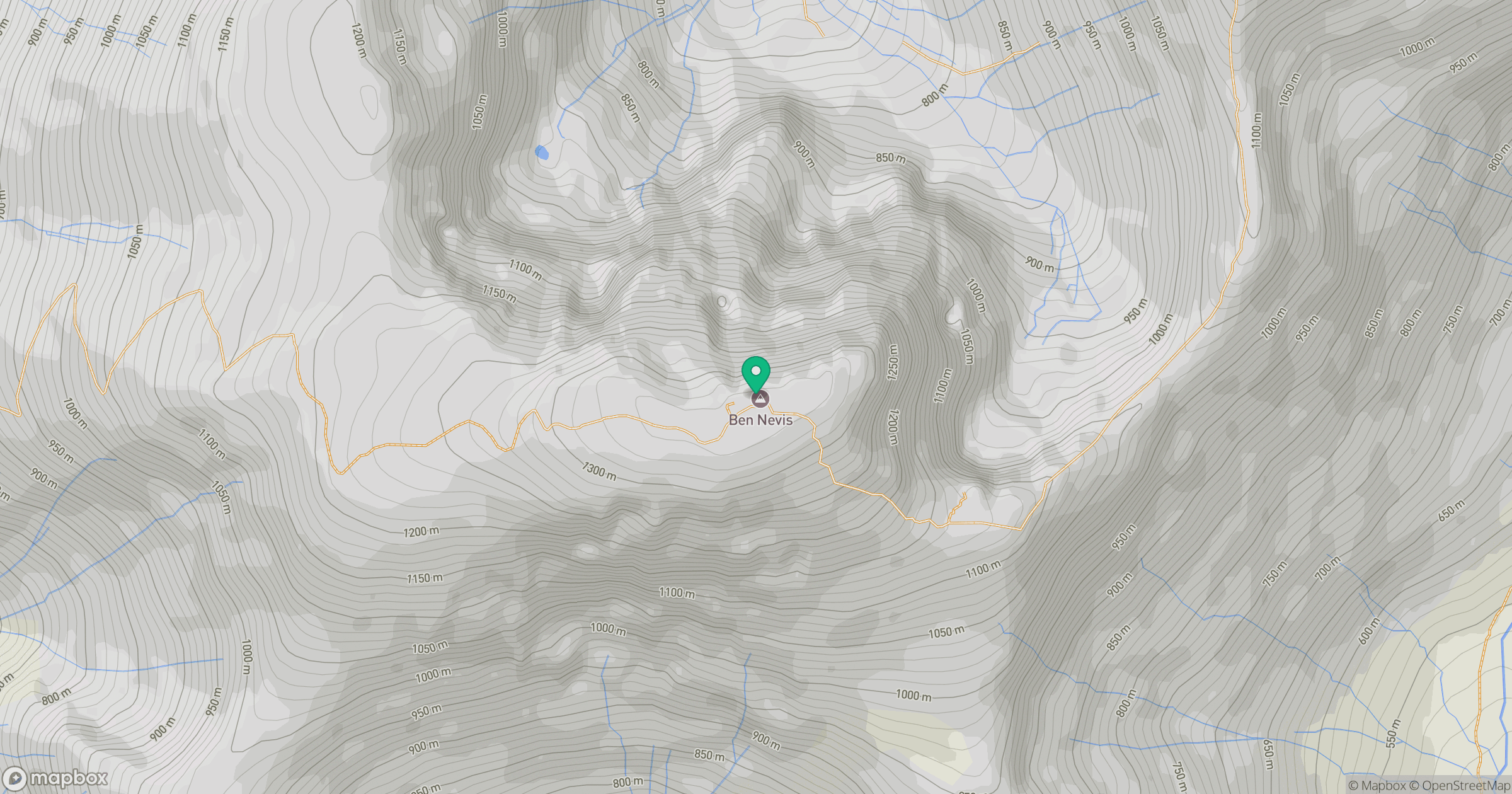
Grid reference: NN166712
View on OpenStreetMapOpens a map in a new tab, centred on the hill.
No comments yet. Be the first.